


Annual Visible Night Light V2 (VIIRS)
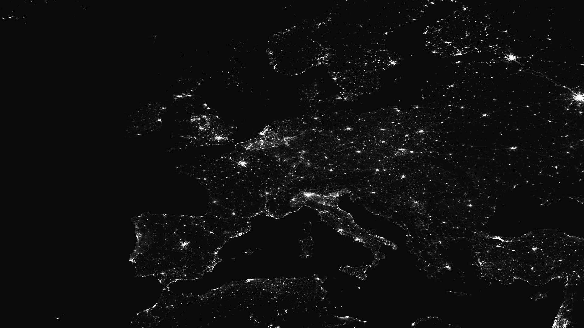
The Annual Visible Night Light V2 dataset offers global maps of night-time light intensity for each year. The data is derived from the Visible Infrared Imaging Radiometer Suite (VIIRS) Day/Night Band and provides processed radiance values at a 500 m spatial resolution (15 arc-seconds). It covers the years 2012–2021, with earlier values (back to 2000) estimated using logistic regression models. These observations of night-time lights are widely used to track human activity, supporting research on urban growth, economic development, and changes in global illumination patterns.

Dataset details:
The Annual Visible Night Light V2 dataset is an improved version of the earlier Visible Night Light V1 products. It uses refined processing methods for cloud removal, outlier filtering, and background light separation. The data are based on monthly cloud-free VIIRS DNB composites that are averaged into annual products. This approach reduces the influence of short-term light sources such as wildfires or auroras. In this case, observations without stray light contamination are used, which improves the quality of the annual maps. Each grid cell is processed with multi-year thresholds to separate real lighting from background noise. This ensures consistent detection of stable night-time lights over time. For the years 2000–2011, light intensity was estimated using logistic regression models trained on the 2012–2021 records. The reconstructed data supports long-term trend analysis, but results may be less certain in areas where light patterns change quickly.
| Collection type | Static |
| Temporal coverage | 2000–2021 |
| Access interfaces | S3 cloud access, STAC (available soon) |
| Path to repository | s3://eodata/auxdata/external/nightlights_average_viirs_v21/ |
| Product count | 22 |
| Size | 1.6 GB |
| Satellite data used | Suomi-NPP, NOAA-20 |
| Data Type | Radiance Raster |
| Processing Level | L3 |
| File Format | Cloud-Optimized GeoTIFF (COG, .tif) |
| Spatial Resolution | 500 m |
| Coordinate Reference System | EPSG:4326 |
| Spatial coverage | Global |
| License | CC-BY-4.0 |