


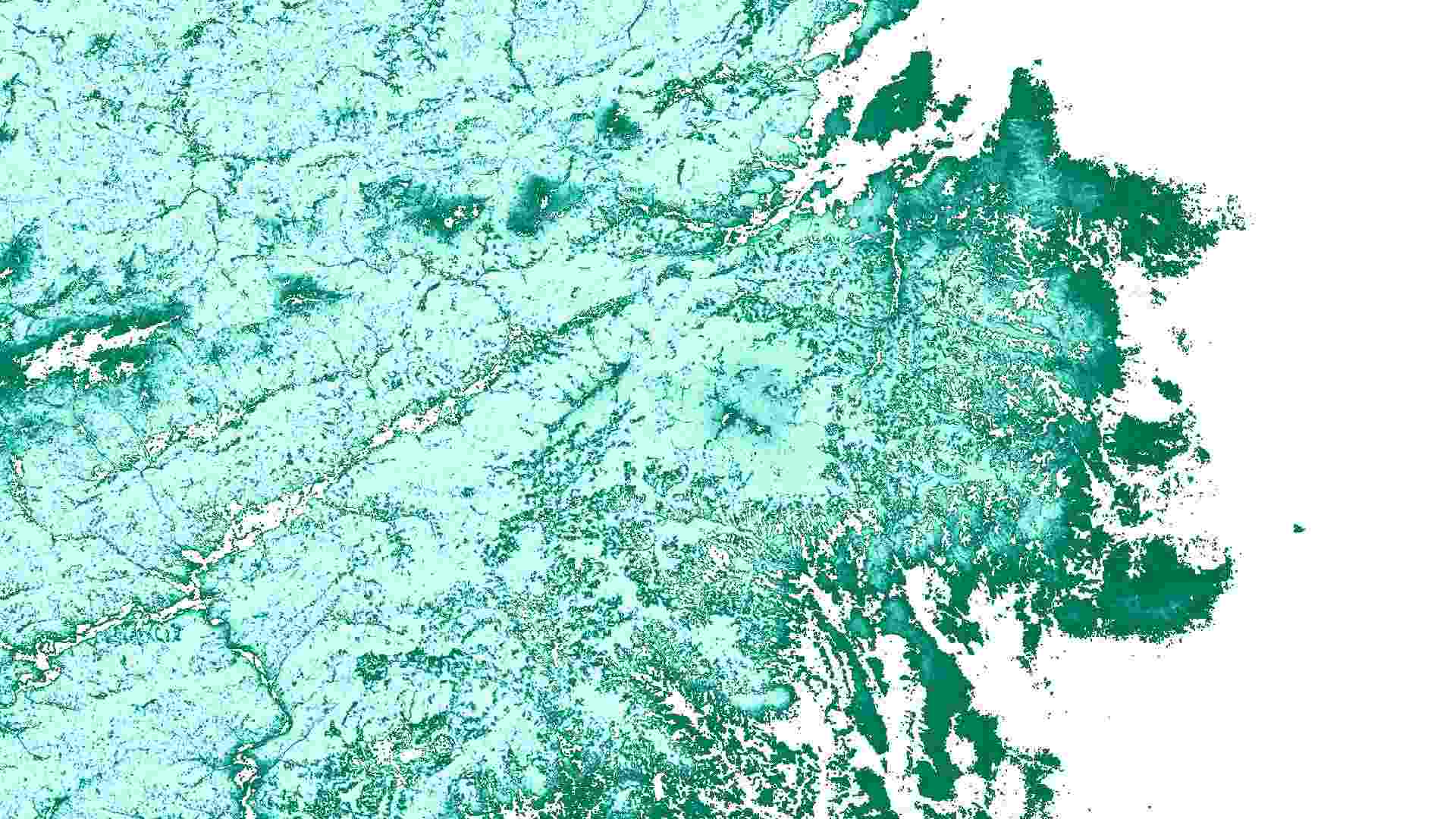
OpenGeoHub Actual Probability Distribution for Abies Alba
The Actual Natural Vegetation (ANV) dataset provides spatially explicit probability maps showing the realized distribution of Silver fir (Abies alba) across Europe from 2000 to 2020. It estimates the likelihood of species presence under current environmental and land-use conditions, supporting biodiversity monitoring, forest assessment, and climate impact research. The maps have a 30 m spatial resolution and use the LAEA Europe projection (EPSG:3035), enabling analyses from local to continental scales.

Dataset details:
The dataset is generated using an ensemble machine learning approach trained on harmonized in situ species records and environmental predictors such as climate, topography, and spectral reflectance. Three base models (Random Forest, XGBoost, and Generalized Linear Models) are combined into a meta-learning logistic regression model to estimate species occurrence probabilities. Dynamic predictors are averaged over four-year periods, and predictions are produced for sequential time windows from 2000–2002 to 2018–2020.
| Collection type | Static |
|---|---|
| Temporal coverage | 2000-2020 |
| Access interfaces | S3 cloud access, STAC (available soon) |
| Path to repository | s3://eodata/auxdata/external/veg_abies_alba_anv_eml/ |
| Product count | 6 |
| Size | 11.4 GB |
| Satellite data used | Not specified |
| Data Type | Distribution Probability Raster |
| Processing Level | L4 |
| File Format | Cloud-Optimized GeoTIFF (COG, .tif) |
| Spatial Resolution | 30 m |
| Coordinate Reference System | EPSG:3035 |
| Spatial coverage | Global |
| License | CC-BY-SA-4.0 |