What we learned from FOSS4G Europe 2025
By Patryk Grzybowski, Data Scientist at CloudFerro
FOSS4G Europe 2025 is a wrap – time for some reflections. This year's edition took place in the city of Mostar, Bosnia-Herzegovina, on 14-20 July, and brought together an inspiring mix of people passionate about open geospatial technologies, from developers and researchers to public sector experts and private companies. These are the key insights from the event we learned:
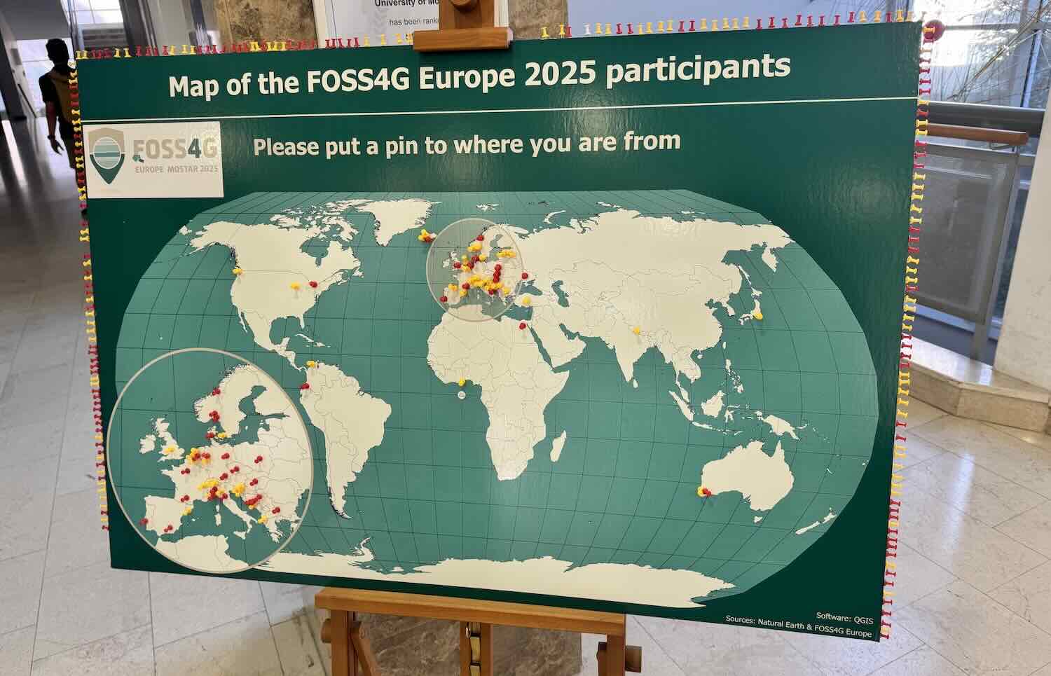
The European FOSS4G community has found its place in the global open source geospatial movement
For the second year in a row, we have had “our own” European edition of the conference. A third one is already on the horizon, and perhaps most importantly, we’re seeing stable attendance and growing cohesion within the European scene.
But what does it actually mean? I believe it shows that we’re growing more confident in appreciating European solutions, implementations, and projects. And what is important – we are not closing ourselves off. FOSS4G Europe is also a place to meet guests from outside the continent. Because what truly connects us is ‘openness’, no matter where it is rooted. And speaking of ‘opennes’...
The idea of “Openness” is no longer a simple concept
Especially when it comes to data, the conversation is getting deeper. In today’s uncertain times marked by geopolitical issues, raise of AI and other rapid technological shifts, openness is no longer a paradigm. It is conscious choice, shaped by context and consequences.
Key questions are now being raised, such as:
- Should all data be open and free for everyone, no matter what?
- Where do we draw the line between transparency and responsibility?
- How do we stay open while protecting critical infrastructure and societal resilience?
This issue appears to be particularly important in the context of geospatial data, which provides information about the location and condition of objects, lands and any object of interest.
Standards like STAC are now mature and widely adopted
The era of working with entire images is over. It is time to work with specific spectral bands. The days of dedicating entire conference blocks to explaining STAC are over. STAC has evolved into a stable, production-ready solution and is becoming a core part of modern geospatial workflows. We are moving beyond “what is STAC?” and into “how do we build around it?” Earth observation data without STAC is increasingly seen as less valuable and this is now simply taken for granted.
AI is making a real entrance into open geo
Whether through mapping assistants, scientific tools, or geospatial LLMs, AI was everywhere this year. This feels like the beginning of a major shift in how we work with data.
AI is playing a crucial role in democratizing data, breaking down technical barriers and enabling a wider range of people and organizations to engage with geospatial information. This opens up new possibilities for collaboration, innovation, and informed decision-making across diverse communities.
The recent FOSS4G Europe has demonstrated that widely accepted open technology standards in geospatial domain have become firmly established, and their use is steadily growing across the industry. We strongly believe that open source technologies play a crucial role in advancing accessibility, affordability, and flexibility, all of which are essential for driving innovation and expanding the societal impact of geospatial solutions.