


Remote Sensing in Beekeeping
Authors: Barbara Taberska (Media Specialist, Erend Space P.S.A.), Bartłomiej Żyliński ( Principal Software Architect, Erend Space P.S.A.)
Problems in modern beekeeping
Honey bees are responsible for pollinating 50-60% of all insect-pollinated species. In Poland, about 60 plant species are cultivated, whose yields depend on pollination by insects. As of now, beekeepers face a variety of problems, including bee colony losses linked to a range of factors. These include varroa mites, pesticide usage, climate change, as well as bee hunger, monotonous food sources, and environmental stressors. A decline in the honey bee population leads to lower crop yields and financial losses across the agricultural sector. The Apidae family also struggles with crop diversification. The decline in crop diversity reduces the available food base, which can result in inefficient honey production. It is also dangerous for humans, as it threatens global food security by making the food system vulnerable to pests, limiting nutrition, and even increasing risks of widespread harvest failure.
What is Hive Mind?
In this changing climate, beekeepers have trouble asserting the best location for their new apiaries. It is especially important to find the most fruitful area for their bees - it directly impacts honey yields and, therefore, beekeepers' income. Currently, beekeepers typically address this problem via a range of options, such as trial and error, local knowledge, fragmented information, or solely based on their experience. It can be time-consuming and costly to drive to different locations to assess crop diversity in person. They also face limitations such as a lack of up-to-date forage maps, difficulty predicting nectar flows, or just limited access to environmental data. These challenges lead to lower yields, higher winter losses, and - perhaps most critically - inefficient apiary placement.
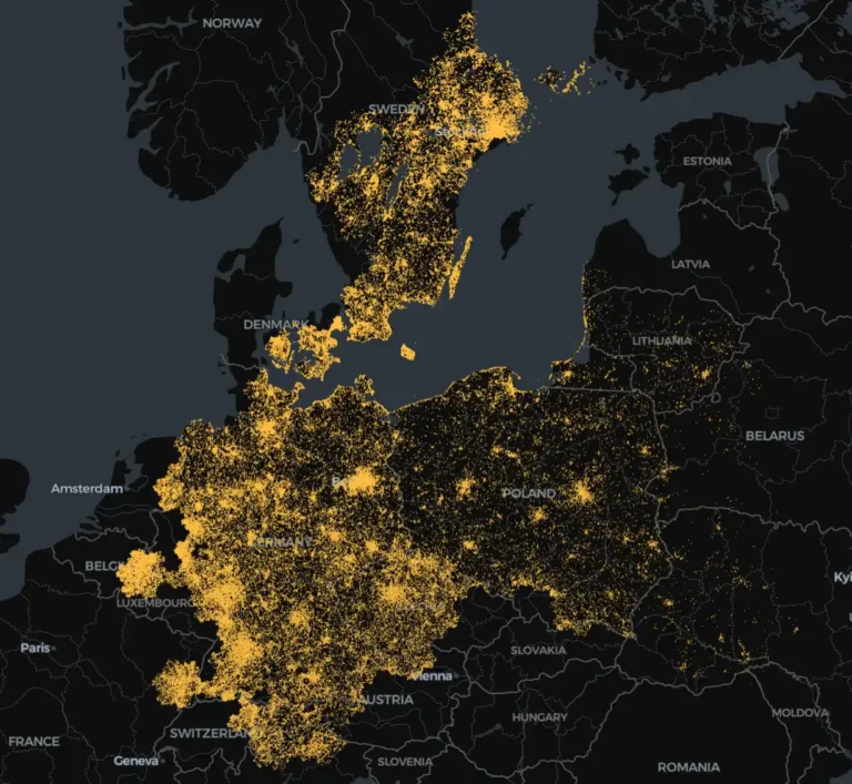
Hive Mind is a digital ecosystem linking beekeepers, landowners, and consumers in a single decision-support platform. In Poland, apiary densities in some regions are extremely high. Because of this, in these areas, intensive competition of pollinators for floral resources can reduce honey yields for beekeepers and put even greater pressure on wild pollinator species, which often have more specific habitats and forage requirements. Hive Mind can, most importantly, help with the reduction of local overstocking. This can alleviate pressure on wild pollinators and support more stable forage availability. Directly, this means that beekeepers can maintain or increase profitability while knowing their decisions are more compatible with broader pollinator conservation goals. Beekeepers and pollinators are not the only ones that could benefit from this situation; for landowners this means improved crop pollination if they make parts of their land available.
Inside Hive Mind
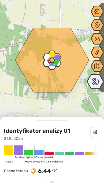
Hive Mind combines Earth observation satellite data, AI algorithms, and geospatial analytics to analyze areas chosen by the user. Before the analysis, the user can set an analysis radius ranging from 100 to 2000 meters (which is an optimal flight distance for a honey bee - beyond this range, the bees expend more energy returning to the hive than they can bring back in the form of pollen.) It is also possible to measure area and perimeter, check weather conditions, and mark custom locations.
After an analysis is conducted, the app yields a report consisting of the percentage of probability that particular species are growing in the area, as shown below:
Hive Mind then provides an evaluation score for the terrain and apiary; higher scores indicate better potential honey yields for that location. Hive Mind also integrates an AI assistant named Maya. During hive inspections, note-taking can be challenging for beekeepers. Documenting hive data is essential, and this is where Maya helps by actively listening to beekeepers and preparing notes from the inspection. Users can review, edit, or add information as needed and access their session history with Maya.
Types of data inputs
At Hive Mind, extensive use is made of satellite imagery, with weather data also utilized but in much smaller volumes. Satellite imagery is crucial for both daily operations and long-term objectives. Therefore, fast and reliable access to Earth observation data is not just “nice to have”, but a core requirement. Data is accessed through the CREODIAS platform and its EODATA repository (EODATA nodes). Due to usage patterns involving normal operations and machine learning model training, the full allowed bandwidth of the EODATA repository is typically used. For this reason, particular attention has been given to optimizing cooperation with the repository.
A support ticket was submitted to CREODIAS to address this matter. The support team approached the problem collaboratively, providing detailed answers, and sharing best practices for working with EODATA at scale.
Processing
As stated above, Hive Mind performs extensive satellite imagery processing, which places a high load on the EODATA repository. The processing pipeline ingests Copernicus Sentinel data - primarily Sentinel-1 and Sentinel-2 - selected according to geolocation and time window. For each geolocation selected by the user, processing begins by retrieving a multi-band Sentinel-2 image stack (nine spectral channels spanning visible, red-edge, and near-infrared) together with the corresponding Sentinel-1 SAR observations (two channels), resulting in a total of eleven channels from both satellites. All inputs are resampled to a common resolution for both input sources.
Each sample is enriched with forage-related context derived from GBIF. The resulting “tuple” - multi-channel satellite inputs paired with forage features - serves as the fundamental unit for model training. For inference, the same satellite inputs are used while omitting the GBIF enrichment.
To improve robustness, standard training augmentations are applied:
- Hexagon rotation and clipping
- Horizontal flip
- Time series shuffling
Because training requires repeated passes over the dataset, efficiency is improved by materializing and storing these tuples as a curated dataset rather than regenerating them for each run. The current store is approximately 1.5TB, replicated across CREODIAS, nearline GCS, and physical storage to meet backup requirements. The dataset grows by roughly 150 GB per month, with a long-term objective of expanding coverage to all of Europe.
Results
Thanks to Hive Mind, beekeepers can achieve higher honey yields, improve overwintering success, and reduce the need to move their apiaries to new locations. When it comes to landowners, cooperation with beekeepers means more fruitful yields. Hive Mind offers better site selection, continuous monitoring, and decision making process that is data-driven. Hive Mind’s main value is, as mentioned before, improved apiary sitting and increased honey yield. However, the benefits do not end here: thanks to the app, beekeepers face a lower risk of losing their bees, engage in more sustainable practices, and can broaden their knowledge about their practice.
Sources:
Kucharczyk, M., Krzywonos, M., Błaszczyk, J., Seruga, P., Piekara, A., Zimny, S., & Borowiak, D. (2017). Problemy pszczelarstwa w Polsce. Prace Naukowe Uniwersytetu Ekonomicznego We Wrocławiu, (494), 123-131.
Loika, H. (2022). Cicha pandemia pszczół. Tutoring Gedanensis, 7 (3), 51-56.Radzikowski, P. (2018). Wpływ utraty bioróżnorodności agroekosystemów na spadek populacji owadów zapylających ze szczególnym uwzględnieniem pszczoły miodnej. Zagadnienia Doradztwa Rolniczego, 91(1), 78-86.
Teper, D. Ocena bioróżnorodności dzikich owadów zapylających oraz pożytków pszczelich w rejonach intensywnych upraw rolniczych.
Roman, A. Główne wyzwania i problemy współczesnego pszczelarstwa